Location: Inner West and Western Sydney, NSW
Client: Multiple Civil & Infrastructure Contractors
Timeline: 2019 – 2024
Geotrace Australia has provided critical utility locating, non-destructive excavation, and subsurface investigation services across several stages of the WestConnex program — including works related to tunnelling interfaces, surface road realignments, and utility relocations. Our role supported Tier 1 and Tier 2 contractors working on components of the M4, M5 and Rozelle Interchange packages.
Utility Locating – Surface Works & Service Relocation Interfaces
Geotrace was contracted to carry out underground utility locating at key connection points across Homebush, St Peters, and Leichhardt. These works were essential for identifying live services near proposed entry and exit ramps, diversion routes, and tunnel portals.
Our technicians used both electromagnetic field detection and GPR scanning to mark out a range of buried assets, including gas, water, telecommunications, and high-voltage electrical lines. Given the density and complexity of the underground environment, particular care was taken to verify undocumented or shallow assets adjacent to active traffic corridors.
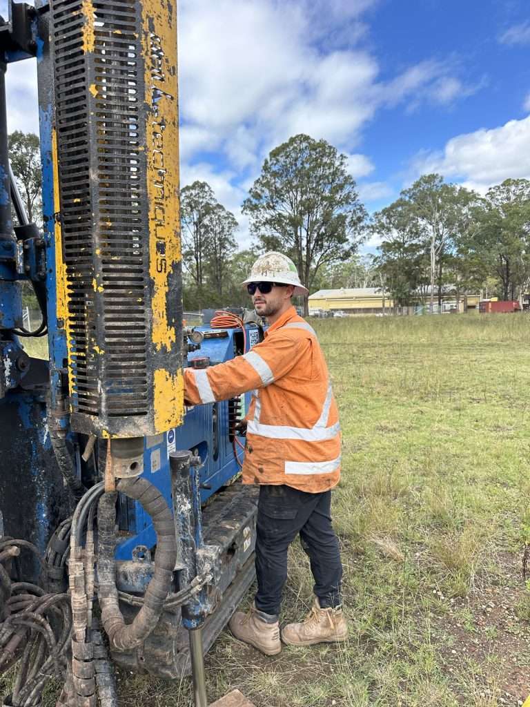
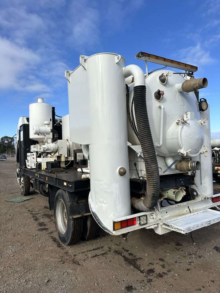
Non-Destructive Excavation – Service Clearance in Restricted Zones
To confirm the location of critical infrastructure prior to trenching, Geotrace performed non-destructive excavation (vacuum potholing) in constrained environments, such as median strips, pedestrian zones, and around traffic signal infrastructure.
Much of this work was completed during night shifts to accommodate traffic management requirements and ensure safety. Our verified results were submitted with photographs, depths, and location coordinates, feeding directly into utility adjustment planning.
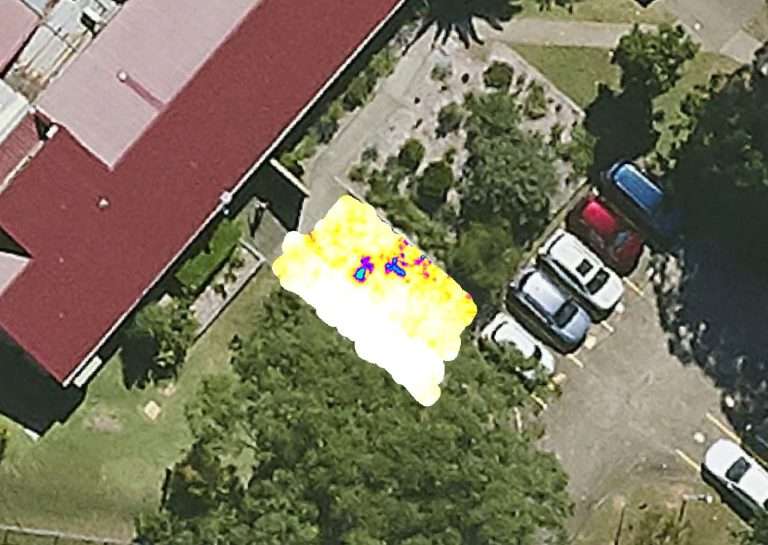
GPR Scanning – Heritage Overlay and Environmental Impact Areas
As part of environmental compliance and design development, Geotrace conducted targeted GPR scanning across areas with known or potential heritage overlays, particularly near tunnel ventilation outlets and stormwater detention basins.
Our scanning results helped minimise disturbance in sensitive zones and informed redesigns that reduced the need for invasive excavation. In these instances, GPR was selected specifically to preserve subsurface integrity while still gathering the required spatial data.