Aerial Utility and Infrastructure Inspections by CASA Certified Drone Operators
Geotrace Australia provides professional drone services operated by CASA-certified REPL (Remote Pilot Licence) and REOC (Remote Operator Certificate) holders. Our drone solutions enhance safety, speed, and precision in utility detection, infrastructure mapping, and hard-to-reach inspections — delivering aerial intelligence without disrupting your site.
What Do Our Drone Services Include?
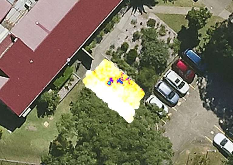
- Aerial Utility Mapping – Capture accurate aerial views of utility corridors, asset locations, and easements
- Topographic Surveys – Generate high-resolution orthomosaics and 3D terrain models
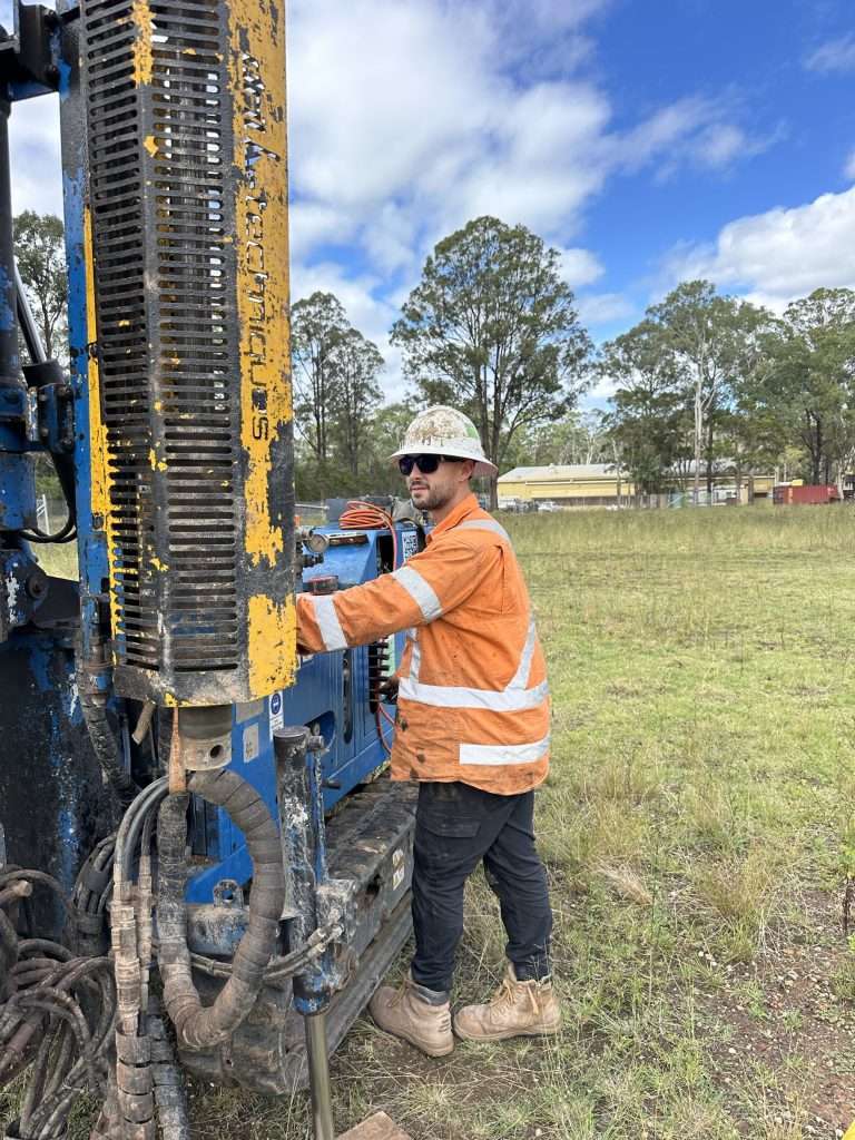
- Infrastructure Inspections – Safely inspect roofs, towers, poles, bridges, and hard-to-access structures
- Environmental & Site Monitoring – Track erosion, vegetation, and surface conditions over time
- Photogrammetry & Modelling – Convert imagery into 2D/3D maps for engineering and GIS applications
Why Use CASA Certified Drone Operators?
Operating drones commercially in Australia requires both licensing and regulatory compliance. Geotrace’s certified drone operators ensure:
- Legal compliance with CASA regulations
- Safe operations in restricted or urban airspace
- Accurate flight planning and data collection
- Insurance coverage for peace of mind
Advantages of Aerial Utility Support
- Improved Safety – No need to send personnel into hazardous or elevated areas
- Faster Turnaround – Cover large or remote areas in a fraction of the time
- High-Resolution Imaging – Pinpoint utility alignments and infrastructure details
- Cost-Effective – Fewer man-hours, equipment needs, and disruptions
- Fully Integrated – Drone data is processed for use in GIS systems or included in utility reports
Who We Support
Our aerial drone services assist:
- Civil and construction engineers
- Surveyors and planners
- Utility providers and councils
- Environmental consultants
- Mining, energy, and infrastructure operators
Aerial Mapping with Accuracy You Can Trust
All Geotrace drone operations are carried out under strict CASA guidelines and backed by decades of geospatial and utility expertise.
📞 Phone: 1300 562 284
📧 Email: info@geotrace.com.au
🌐 http://geotrace.com.au